| Item Detail |
| |
| |
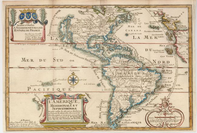
MapMaker: |
Nicolas de Fer
|
|
| |
| |
Subject: |
Western Hemisphere |
|
| |
Period/Size: |
1717 / 8.8" x 13.0" (22.4 x 33.1 cm)
|
|
| |
Color: |
Colored
|
|
| |
Condition: |
(+B) Issued folding, now flattened. A tiny binding tear in the lower left border has been professionally repaired and the binding trim has been replaced. (condition help) |
|
| |
Source: |
Introduction a la geographie… |
|
| |
References: |
Burden #759; McLaughlin #135, Tooley (Amer) #61, p. 126. |
|
| |
|
|
| Sales Information |
| |
| |
Price: |
|
|
| |
| |
Offered by: |
Old World Auctions |
|
| |
Catalog: |
Auction No. 129 - Antique Maps, Charts, Atlases & Globes (680) |
|
| |
Lot/Item #: |
077 |
|
| |
| |
Date: |
09/2009
|
|
| |
| |
|