Title:
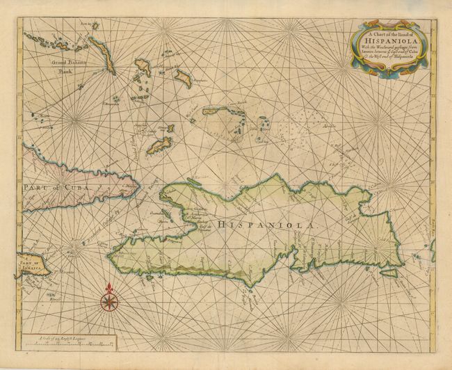
“A Chart of the Iland of Hispaniola, with the Windward Passage from Iamaica between ye East End of Cuba & the West End of Hispaniola”
Map Maker:
Thornton & Seller
This is a very scarce chart of the island of Hispa... (full text available to subscribers)
| Item Detail |
| |
| |
MapMaker: |
Thornton & Seller
|
|
| |
| |
Subject: |
Hispaniola |
|
| |
Period/Size: |
1700 / 16.5" x 20.8" (42.0 x 52.9 cm)
|
|
| |
Color: |
Colored
|
|
| |
Condition: |
(A) Lightly toned with good original margins. There are a couple of light stains and edge tears, not affecting the map. (condition help) |
|
| |
Source: |
The English Pilot, Fourth Book |
|
| |
References: |
|
|
| |
|
|
| Sales Information |
| |
| |
Price: |
|
|
| |
| |
Offered by: |
Old World Auctions |
|
| |
Catalog: |
Auction No. 129 - Antique Maps, Charts, Atlases & Globes (680) |
|
| |
Lot/Item #: |
393 |
|
| |
| |
Date: |
09/2009
|
|
| |
| |
|
Antique Maps - Valuation and Pricing, Descriptions, Resources |
|
Home |
Information |
Search |
Register |
Contact Us |
Site Map
Americana Exchange, Inc. © 1999 - 2024 Americana Exchange, Inc.. All rights reserved.
OldMaps.com, the OldMaps.com logo and
AMPR are service marks or registered service marks of Americana Exchange, Inc..
|