Rister or Sign In to see pricing information


Title:

A Plan of the City and Castle of Batavia

Map Maker:

Herman Moll

A Plan of the City and Castle of Batavia

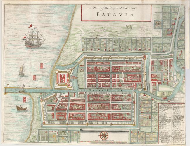
Superb, large bird's-eye plan of the city and fort... (full text available to subscribers)
Item Detail
 
  MapMaker:  

Herman Moll


  Subject:  Jakarta, Indonesia  
  Period/Size:  1724-38 / 12.7" x 16.5"  (32.3 x 42.0 cm)  
  Color:  Colored  
  Condition:  (A) Close trimmed. A short binding trim tear, expertly closed on verso. Issued folding, now flattened. Large eagle watermark. (condition help)  
  Source:   
  References:  Shirley (BI) G.Salm-1a #6.  
 
 
Sales Information
 
  Price: 

Please register your email to view records, or sign in with email address to see records


  Offered by:  Old World Auctions  
  Catalog:  Auction No. 129 - Antique Maps, Charts, Atlases & Globes (680)  
  Lot/Item #:  799  
 
  Date:  09/2009  


Antique Maps - Valuation and Pricing, Descriptions, Resources


Home | Information | Search | Register | Contact Us | Site Map

Americana Exchange, Inc. © 1999 - 2024 Americana Exchange, Inc.. All rights reserved. OldMaps.com, the OldMaps.com logo and
AMPR are service marks or registered service marks of Americana Exchange, Inc..