Title:
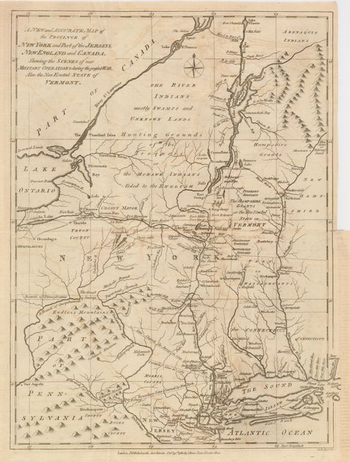
“A New and Accurate Map of the Province of New York and Part of the Jerseys, New England and Canada, Shewing the Scenes of our Military Operations during the present War. Also the New Erected State of Vermont”
Map Maker:
John Lodge
A detailed and interesting map of the field of mil... (full text available to subscribers)
| Item Detail |
| |
| |
MapMaker: |
John Lodge
|
|
| |
| |
Subject: |
New England and Mid-Atlantic |
|
| |
Period/Size: |
1780 / 14.5" x 10.8" (36.9 x 27.5 cm)
|
|
| |
Color: |
Black & White
|
|
| |
Condition: |
(B) Issued folding, now pressed. A short binding side tear is closed with old tape on verso. The dark impression has left some light offsetting throughout. On sound paper with original margins. (condition help) |
|
| |
Source: |
Political Magazine |
|
| |
References: |
Jolly POL-14; Sellers & van Ee #176; McCorkle #780-9. |
|
| |
|
|
| Sales Information |
| |
| |
Price: |
|
|
| |
| |
Offered by: |
Old World Auctions |
|
| |
Catalog: |
Auction No. 129 - Antique Maps, Charts, Atlases & Globes (680) |
|
| |
Lot/Item #: |
193 |
|
| |
| |
Date: |
09/2009
|
|
| |
| |
|
Antique Maps - Valuation and Pricing, Descriptions, Resources |
|
Home |
Information |
Search |
Register |
Contact Us |
Site Map
Americana Exchange, Inc. © 1999 - 2024 Americana Exchange, Inc.. All rights reserved.
OldMaps.com, the OldMaps.com logo and
AMPR are service marks or registered service marks of Americana Exchange, Inc..
|