Title:
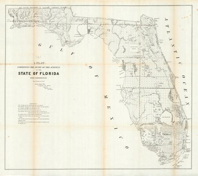
“A Plat Exhibiting the State of the Surveys in the State of Florida”
Map Maker:
U.S. State Surveys
This 1853 edition shows up-to-date survey progress... (full text available to subscribers)
| Item Detail |
| |
| |
MapMaker: |
U.S. State Surveys
|
|
| |
| |
Subject: |
Florida |
|
| |
Period/Size: |
1853 / 21.8" x 24.8" (55.4 x 63.0 cm)
|
|
| |
Color: |
Black & White
|
|
| |
Condition: |
(+B) Minor toning on folds with a couple very tiny fold intersection splits and a few spots of foxing. A couple of the folds are separated in the blank margins. Overall better condition than most government report maps from this period. (condition help) |
|
| |
Source: |
|
|
| |
References: |
|
|
| |
|
|
| Sales Information |
| |
| |
Price: |
|
|
| |
| |
Offered by: |
Old World Auctions |
|
| |
Catalog: |
Auction No. 129 - Antique Maps, Charts, Atlases & Globes (680) |
|
| |
Lot/Item #: |
267 |
|
| |
| |
Date: |
09/2009
|
|
| |
| |
|
Antique Maps - Valuation and Pricing, Descriptions, Resources |
|
Home |
Information |
Search |
Register |
Contact Us |
Site Map
Americana Exchange, Inc. © 1999 - 2024 Americana Exchange, Inc.. All rights reserved.
OldMaps.com, the OldMaps.com logo and
AMPR are service marks or registered service marks of Americana Exchange, Inc..
|