| Item Detail |
| |
| |
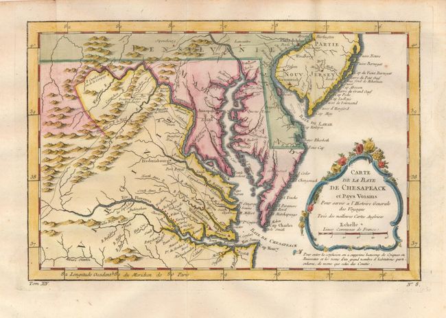
MapMaker: |
Jacques Nicolas Bellin
|
|
| |
| |
Subject: |
Colonial Mid-Atlantic |
|
| |
Period/Size: |
1757 / 7.5" x 11.3" (19.1 x 28.7 cm)
|
|
| |
Color: |
Colored
|
|
| |
Condition: |
(A+) Folding as issued on thick hand laid paper with wide margins. Fine hand coloring and dark impression. A small paper flaw as issued at lower edge and printer's crease along right margin, still fine. (condition help) |
|
| |
Source: |
L'Histoire Generale des Voyages |
|
| |
References: |
Sellers & Van Ee #1383. |
|
| |
|
|
| Sales Information |
| |
| |
Price: |
|
|
| |
| |
Offered by: |
Old World Auctions |
|
| |
Catalog: |
Auction No. 130 - Antique Maps, Charts, Atlases & Globes (681) |
|
| |
Lot/Item #: |
191 |
|
| |
| |
Date: |
12/2009
|
|
| |
| |
|