Title:
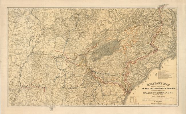
“Military Map Showing the Marches of the United States Forces Under the Command of Maj. Genl. W.T. Sherman U.S.A. during the Years 1863, 1864, and 1865…”
Map Maker:
U.S. Army
Drawn by Captain William Kossak in St. Louis, MO, ... (full text available to subscribers)
| Item Detail |
| |
| |
MapMaker: |
U.S. Army
|
|
| |
| |
Subject: |
Eastern United States, Civil War |
|
| |
Period/Size: |
1865 / 21.5" x 37.0" (54.7 x 94.0 cm)
|
|
| |
Color: |
Colored
|
|
| |
Condition: |
(A+) Map image is fine with strong color and impression and very wide margins. A hint of soiling in margins, still fine. (condition help) |
|
| |
Source: |
|
|
| |
References: |
Stephenson (CW) #73 |
|
| |
|
|
| Sales Information |
| |
| |
Price: |
|
|
| |
| |
Offered by: |
Old World Auctions |
|
| |
Catalog: |
Auction No. 130 - Antique Maps, Charts, Atlases & Globes (681) |
|
| |
Lot/Item #: |
182 |
|
| |
| |
Date: |
12/2009
|
|
| |
| |
|
Antique Maps - Valuation and Pricing, Descriptions, Resources |
|
Home |
Information |
Search |
Register |
Contact Us |
Site Map
Americana Exchange, Inc. © 1999 - 2024 Americana Exchange, Inc.. All rights reserved.
OldMaps.com, the OldMaps.com logo and
AMPR are service marks or registered service marks of Americana Exchange, Inc..
|