Title:
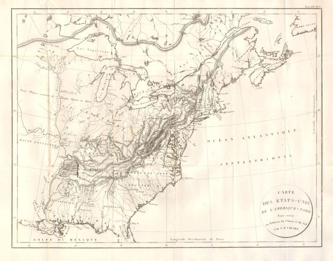
“Carte des Etats-Unis de l'Amerique-Nord”
Map Maker:
Constantin Francois de Chasseborcy de Volney
A nicely engraved copper-plate map that extents fr... (full text available to subscribers)
| Item Detail |
| |
| |
MapMaker: |
Constantin Francois de Chasseborcy de Volney
|
|
| |
| |
Subject: |
Canada & United States |
|
| |
Period/Size: |
1803 / 16.2" x 21.5" (41.2 x 54.7 cm)
|
|
| |
Color: |
Black & White
|
|
| |
Condition: |
(+B) Dark impression on thick hand laid paper with wide margins. Issued folded with binding trim in full left margin. (condition help) |
|
| |
Source: |
Tableau du climat et du sol des Etats-Unis |
|
| |
References: |
|
|
| |
|
|
| Sales Information |
| |
| |
Price: |
|
|
| |
| |
Offered by: |
Old World Auctions |
|
| |
Catalog: |
Auction No. 130 - Antique Maps, Charts, Atlases & Globes (681) |
|
| |
Lot/Item #: |
151 |
|
| |
| |
Date: |
12/2009
|
|
| |
| |
|
Antique Maps - Valuation and Pricing, Descriptions, Resources |
|
Home |
Information |
Search |
Register |
Contact Us |
Site Map
Americana Exchange, Inc. © 1999 - 2024 Americana Exchange, Inc.. All rights reserved.
OldMaps.com, the OldMaps.com logo and
AMPR are service marks or registered service marks of Americana Exchange, Inc..
|