| Item Detail |
| |
| |
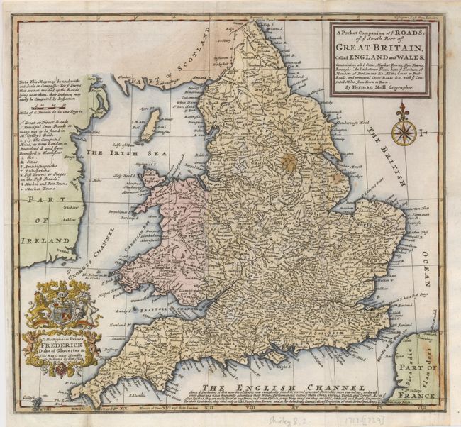
MapMaker: |
Herman Moll
|
|
| |
| |
Subject: |
England & Wales |
|
| |
Period/Size: |
1729 / 10.8" x 11.8" (27.5 x 30.0 cm)
|
|
| |
Color: |
Colored
|
|
| |
Condition: |
(B) Issued folded, now flattened with the binding trim at lower right extended to accommodate framing. A few short fold separations have been repaired with tissue on verso. There are a few small stains in the map. (condition help) |
|
| |
Source: |
Atlas Minor |
|
| |
References: |
Shirley (BI) Moll 8. |
|
| |
|
|
| Sales Information |
| |
| |
Price: |
|
|
| |
| |
Offered by: |
Old World Auctions |
|
| |
Catalog: |
Auction No. 130 - Antique Maps, Charts, Atlases & Globes (681) |
|
| |
Lot/Item #: |
439 |
|
| |
| |
Date: |
12/2009
|
|
| |
| |
|