Title:
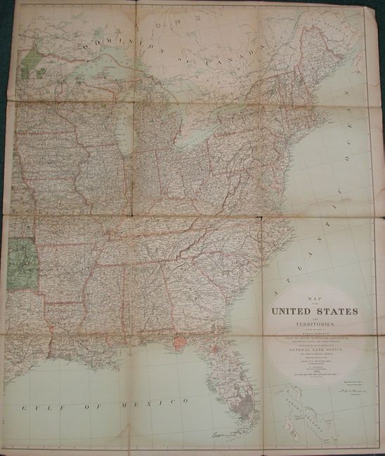
“Map of the United States and Territories Showing the Extent of Public Surveys, Indian and Military Reservations, Land Grant R.R; Rail Roads, Canalsģ”
Map Maker:
General Land Office
The map is on two sheets, both segmented and mount... (full text available to subscribers)
| Item Detail |
| |
| |
MapMaker: |
General Land Office
|
|
| |
| |
Subject: |
United States |
|
| |
Period/Size: |
1882 / 49.0" x 39.0" (124.5 x 99.1 cm)
|
|
| |
Color: |
Colored
|
|
| |
Condition: |
(B) Shows well, but with occasional fold toning and some areas of water staining. Paper sound and linen intact, but with some splits between map segments. (condition help) |
|
| |
Source: |
|
|
| |
References: |
|
|
| |
|
|
| Sales Information |
| |
| |
Price: |
|
|
| |
| |
Offered by: |
Old World Auctions |
|
| |
Catalog: |
Auction No. 130 - Antique Maps, Charts, Atlases & Globes (681) |
|
| |
Lot/Item #: |
162 |
|
| |
| |
Date: |
12/2009
|
|
| |
| |
|
Antique Maps - Valuation and Pricing, Descriptions, Resources |
|
Home |
Information |
Search |
Register |
Contact Us |
Site Map
Americana Exchange, Inc. © 1999 - 2024 Americana Exchange, Inc.. All rights reserved.
OldMaps.com, the OldMaps.com logo and
AMPR are service marks or registered service marks of Americana Exchange, Inc..
|