Title:
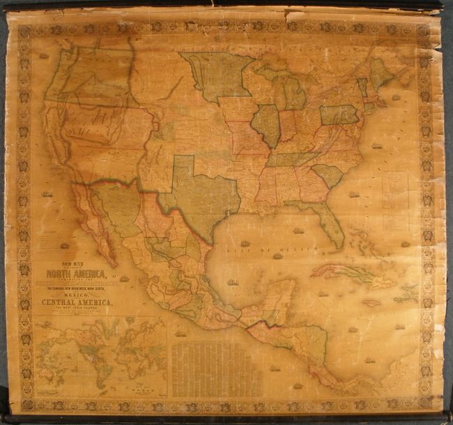
“New Map of that portion of North America, exhibiting the United States and Territories, the Canadas, New Brunswick, Nova Scotia and Mexico, also Central America and the West India Islands”
Map Maker:
Jacob Monk
An early and majestic wall map that was published ... (full text available to subscribers)
| Item Detail |
| |
| |
MapMaker: |
Jacob Monk
|
|
| |
| |
Subject: |
North America and West Indies |
|
| |
Period/Size: |
1852 / 55.4" x 59.5" (140.8 x 151.2 cm)
|
|
| |
Color: |
Colored
|
|
| |
Condition: |
(+C) Overall light darkening of varnish. Sides without cloth edging, with some roughness and small tears at right and a few small areas of edge loss, one just into the border. The top margin has the primary damage as normally seen. Upper margin has two (condition help) |
|
| |
Source: |
|
|
| |
References: |
Wheat (TMW) #757; Wheat (GOLD) #243. |
|
| |
|
|
| Sales Information |
| |
| |
Price: |
|
|
| |
| |
Offered by: |
Old World Auctions |
|
| |
Catalog: |
Auction No. 130 - Antique Maps, Charts, Atlases & Globes (681) |
|
| |
Lot/Item #: |
113 |
|
| |
| |
Date: |
12/2009
|
|
| |
| |
|
Antique Maps - Valuation and Pricing, Descriptions, Resources |
|
Home |
Information |
Search |
Register |
Contact Us |
Site Map
Americana Exchange, Inc. © 1999 - 2024 Americana Exchange, Inc.. All rights reserved.
OldMaps.com, the OldMaps.com logo and
AMPR are service marks or registered service marks of Americana Exchange, Inc..
|