Title:
“The Royal Illustrated Atlas, of Modern Geography with an Introductory Notice by De. N. Shaw, Secretary to the Royal Geographical Society”
Map Maker:
Archibald Fullarton [& Co.]
Very lovely and complete folio atlas published by ... (full text available to subscribers)
| Item Detail |
| |
| |
MapMaker: |
Archibald Fullarton [& Co.]
|
|
| |
| |
Subject: |
Atlases |
|
| |
Period/Size: |
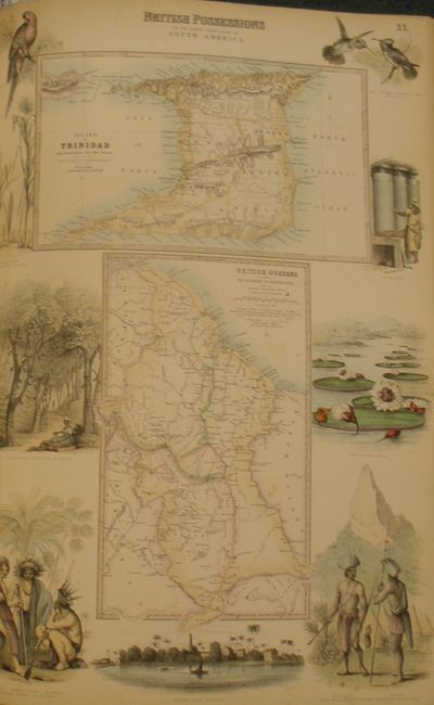
1864-72 / 19.0" x 13.0" (48.3 x 33.1 cm)
|
|
| |
Color: |
Colored
|
|
| |
Condition: |
(A) The map of the Black & Caspian Seas heavily foxed. The majority of pages are very good to fine with the occasional spot. End pages are more prone to foxing spots, as commonly seen. Boards are slightly rubbed and scuffed along edges and at spine. S (condition help) |
|
| |
Source: |
|
|
| |
References: |
|
|
| |
|
|
| Sales Information |
| |
| |
Price: |
|
|
| |
| |
Offered by: |
Old World Auctions |
|
| |
Catalog: |
Auction No. 130 - Antique Maps, Charts, Atlases & Globes (681) |
|
| |
Lot/Item #: |
860 |
|
| |
| |
Date: |
12/2009
|
|
| |
| |
|
Antique Maps - Valuation and Pricing, Descriptions, Resources |
|
Home |
Information |
Search |
Register |
Contact Us |
Site Map
Americana Exchange, Inc. © 1999 - 2024 Americana Exchange, Inc.. All rights reserved.
OldMaps.com, the OldMaps.com logo and
AMPR are service marks or registered service marks of Americana Exchange, Inc..
|