| Item Detail |
| |
| |
MapMaker: |
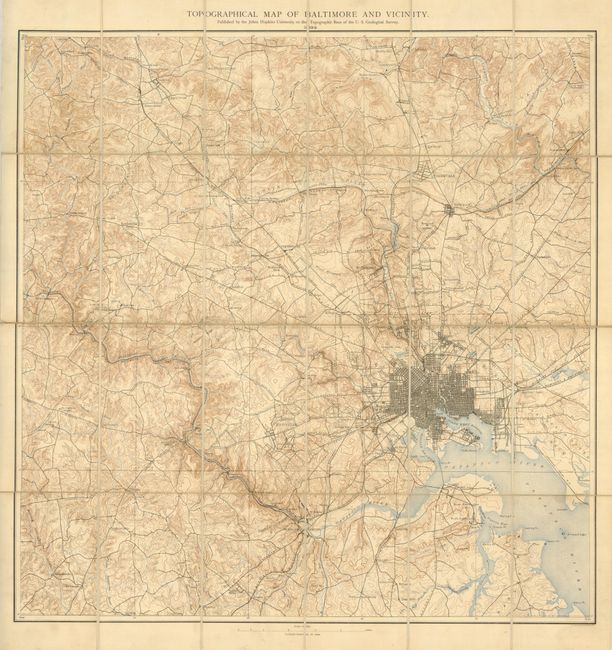
U.S. Geological Survey
|
|
| |
| |
Subject: |
Baltimore, Maryland |
|
| |
Period/Size: |
1892 / 24.0" x 23.5" (61.0 x 59.7 cm)
|
|
| |
Color: |
Colored
|
|
| |
Condition: |
(A) The map is generally clean with just a hint of toning on a few linen/paper edges and some old pencil titles on the linen. Case is rubbed with the cloth frayed along the bottom edge. (condition help) |
|
| |
Source: |
|
|
| |
References: |
|
|
| |
|
|
| Sales Information |
| |
| |
Price: |
|
|
| |
| |
Offered by: |
Old World Auctions |
|
| |
Catalog: |
Auction No. 130 - Antique Maps, Charts, Atlases & Globes (681) |
|
| |
Lot/Item #: |
274 |
|
| |
| |
Date: |
12/2009
|
|
| |
| |
|