Title:
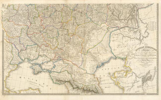
“The Russian Dominions in Europe drawn from the latest Maps printed, by the Academy of Sciences, St. Petersburg; revised and corrected, with the Post Roads & New Governments, from the Russian Atlas of 1806; by Jaspar Nantiat”
Map Maker:
James Wyld
Superb, large-scale map printed on two sheets of w... (full text available to subscribers)
| Item Detail |
| |
| |
MapMaker: |
James Wyld
|
|
| |
| |
Subject: |
Eastern Europe, Russia |
|
| |
Period/Size: |
1842 / 21.0" x 36.0" (53.4 x 91.5 cm)
|
|
| |
Color: |
Colored
|
|
| |
Condition: |
(+B) Printed on sturdy paper with original outline color. The top sheets have fold separations that just enter the map and there is some faint offsetting. (condition help) |
|
| |
Source: |
A New Atlas of Modern Geography |
|
| |
References: |
|
|
| |
|
|
| Sales Information |
| |
| |
Price: |
|
|
| |
| |
Offered by: |
Old World Auctions |
|
| |
Catalog: |
Auction No. 130 - Antique Maps, Charts, Atlases & Globes (681) |
|
| |
Lot/Item #: |
572 |
|
| |
| |
Date: |
12/2009
|
|
| |
| |
|
Antique Maps - Valuation and Pricing, Descriptions, Resources |
|
Home |
Information |
Search |
Register |
Contact Us |
Site Map
Americana Exchange, Inc. © 1999 - 2024 Americana Exchange, Inc.. All rights reserved.
OldMaps.com, the OldMaps.com logo and
AMPR are service marks or registered service marks of Americana Exchange, Inc..
|