Rister or Sign In to see pricing information


Title:

Geographical, Historical and Statistical Map of Kentucky

Map Maker:

Carey & Lea

Geographical, Historical and Statistical Map of Kentucky

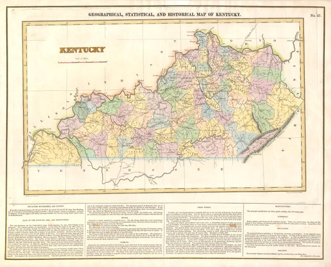
The map is on a full folio sheet (22" x 17.3") wit... (full text available to subscribers)
Item Detail
 
  MapMaker:  

Carey & Lea


  Subject:  Kentucky  
  Period/Size:  1822 / 11.3" x 18.5"  (28.7 x 47.0 cm)  
  Color:  Colored  
  Condition:  (A) The map image is near fine with lovely original color and bright image, small crease at upper right. Text at bottom has two small opposing stains. (condition help)  
  Source:   
  References:   
 
 
Sales Information
 
  Price: 

Please register your email to view records, or sign in with email address to see records


  Offered by:  Old World Auctions  
  Catalog:  Auction No. 130 - Antique Maps, Charts, Atlases & Globes (681)  
  Lot/Item #:  268  
 
  Date:  12/2009  


Antique Maps - Valuation and Pricing, Descriptions, Resources


Home | Information | Search | Register | Contact Us | Site Map

Americana Exchange, Inc. © 1999 - 2024 Americana Exchange, Inc.. All rights reserved. OldMaps.com, the OldMaps.com logo and
AMPR are service marks or registered service marks of Americana Exchange, Inc..