Title:
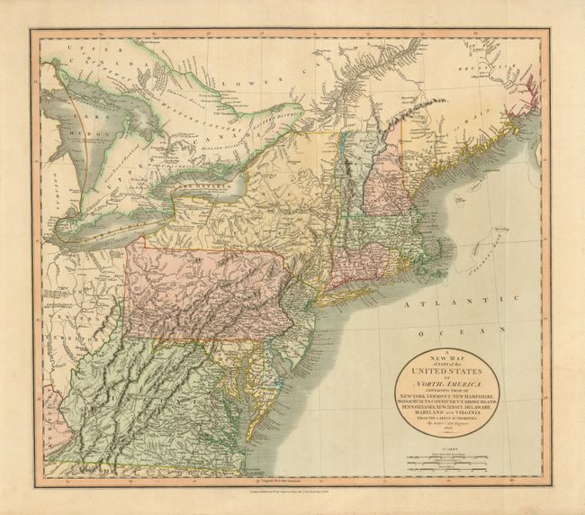
“A New Map of Part of the United States of North America, Containing those of New York, Vermont, New Hampshire, Massachusetts, Connecticut, Rhode Island, Pennsylvania, New Jersey, Delaware, Maryland and Virginia. From the Latest Authorities.”
Map Maker:
John Cary
This is a fine, early 19th century map of the stat... (full text available to subscribers)
| Item Detail |
| |
| |
MapMaker: |
John Cary
|
|
| |
| |
Subject: |
Eastern United States |
|
| |
Period/Size: |
1806 / 18.0" x 20.5" (45.8 x 52.1 cm)
|
|
| |
Color: |
Colored
|
|
| |
Condition: |
(A+) Crisp impression and lovely original color. (condition help) |
|
| |
Source: |
New Universal Atlas |
|
| |
References: |
|
|
| |
|
|
| Sales Information |
| |
| |
Price: |
|
|
| |
| |
Offered by: |
Old World Auctions |
|
| |
Catalog: |
Auction No. 130 - Antique Maps, Charts, Atlases & Globes (681) |
|
| |
Lot/Item #: |
171 |
|
| |
| |
Date: |
12/2009
|
|
| |
| |
|
Antique Maps - Valuation and Pricing, Descriptions, Resources |
|
Home |
Information |
Search |
Register |
Contact Us |
Site Map
Americana Exchange, Inc. © 1999 - 2024 Americana Exchange, Inc.. All rights reserved.
OldMaps.com, the OldMaps.com logo and
AMPR are service marks or registered service marks of Americana Exchange, Inc..
|