| Item Detail |
| |
| |
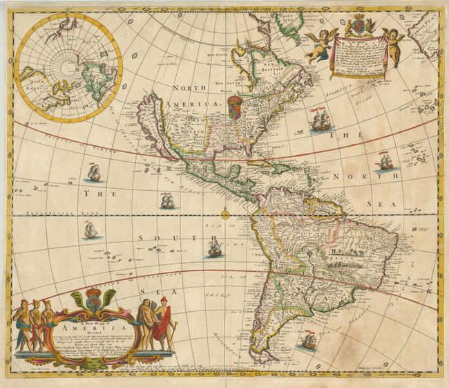
MapMaker: |
Lea & Overton
|
|
| |
| |
Subject: |
Western Hemisphere |
|
| |
Period/Size: |
1688 / 18.8" x 22.3" (47.8 x 56.7 cm)
|
|
| |
Color: |
Colored
|
|
| |
Condition: |
(B) Sharp impression and original color with some spots in the unengraved areas of the Atlantic Ocean. There is an old paper repair in the bottom margin. (condition help) |
|
| |
Source: |
|
|
| |
References: |
Burden #593; McLaughlin #106; Pritchard & Taliaferro fig #245; Tooley (Amer) #54, p. 124. |
|
| |
|
|
| Sales Information |
| |
| |
Price: |
|
|
| |
| |
Offered by: |
Old World Auctions |
|
| |
Catalog: |
Auction No. 130 - Antique Maps, Charts, Atlases & Globes (681) |
|
| |
Lot/Item #: |
078 |
|
| |
| |
Date: |
12/2009
|
|
| |
| |
|