Title:
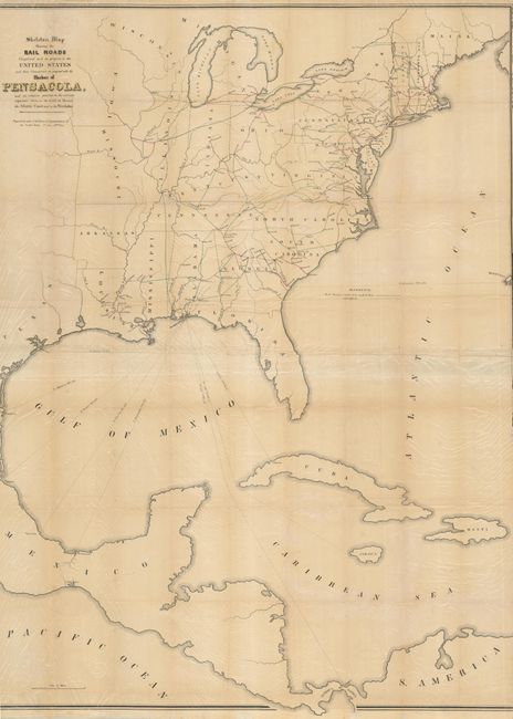
“Skeleton Map Showing Railroads Completed and in Progress in the United States and their Connection as Proposed with the Harbour of Pensacola…”
Map Maker:
U.S. Government
Outline map of the eastern half of the United Stat... (full text available to subscribers)
| Item Detail |
| |
| |
MapMaker: |
U.S. Government
|
|
| |
| |
Subject: |
Eastern United States |
|
| |
Period/Size: |
1847-48 / 48.0" x 36.0" (122.0 x 91.5 cm)
|
|
| |
Color: |
Black & White
|
|
| |
Condition: |
(B) Issued folding now flattened with tissue reinforced folds. (condition help) |
|
| |
Source: |
|
|
| |
References: |
|
|
| |
|
|
| Sales Information |
| |
| |
Price: |
|
|
| |
| |
Offered by: |
Old World Auctions |
|
| |
Catalog: |
Auction No. 130 - Antique Maps, Charts, Atlases & Globes (681) |
|
| |
Lot/Item #: |
180 |
|
| |
| |
Date: |
12/2009
|
|
| |
| |
|
Antique Maps - Valuation and Pricing, Descriptions, Resources |
|
Home |
Information |
Search |
Register |
Contact Us |
Site Map
Americana Exchange, Inc. © 1999 - 2024 Americana Exchange, Inc.. All rights reserved.
OldMaps.com, the OldMaps.com logo and
AMPR are service marks or registered service marks of Americana Exchange, Inc..
|