Title:
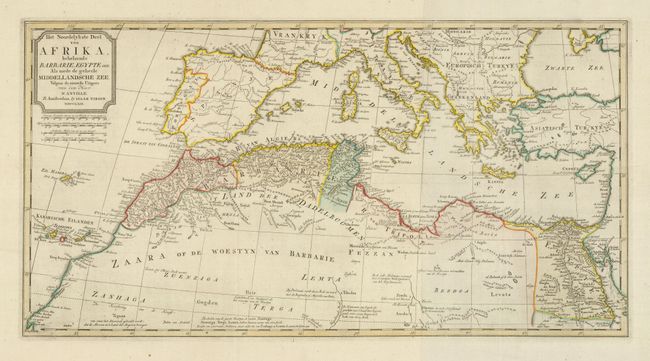
“Het Noordelykste deel van Afrika, behelzende Barbarie, Egypte enz. Als mede de geheele Middellandsche Zee…”
Map Maker:
Isaac Tirion
This large map covers the southern part of Europe,... (full text available to subscribers)
| Item Detail |
| |
| |
MapMaker: |
Isaac Tirion
|
|
| |
| |
Subject: |
Northern Africa and Mediterranean |
|
| |
Period/Size: |
1762 / 12.7" x 24.4" (32.3 x 62.0 cm)
|
|
| |
Color: |
Colored
|
|
| |
Condition: |
(A) Wide original margins and original color. There is a soft horizontal fold and remnants of brown paper hinges on verso, else fine. (condition help) |
|
| |
Source: |
Nieuwe en Beknopte Hand Atlas |
|
| |
References: |
|
|
| |
|
|
| Sales Information |
| |
| |
Price: |
|
|
| |
| |
Offered by: |
Old World Auctions |
|
| |
Catalog: |
Auction No. 131 - Antique Maps, Charts, Atlases & Globes (682) |
|
| |
Lot/Item #: |
857 |
|
| |
| |
Date: |
02/2010
|
|
| |
| |
|
Antique Maps - Valuation and Pricing, Descriptions, Resources |
|
Home |
Information |
Search |
Register |
Contact Us |
Site Map
Americana Exchange, Inc. © 1999 - 2024 Americana Exchange, Inc.. All rights reserved.
OldMaps.com, the OldMaps.com logo and
AMPR are service marks or registered service marks of Americana Exchange, Inc..
|