Title:
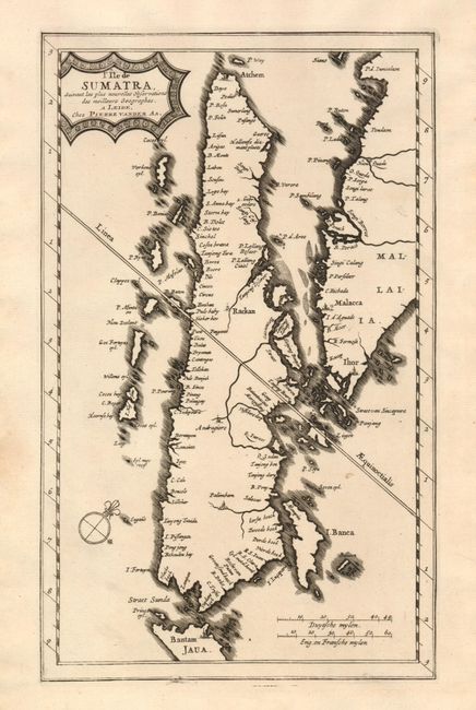
“l'Ile de Sumatra Suivant les plus Nouvelles Observations des Meilleurs Geographes”
Map Maker:
Pieter van der Aa
This is a fine, rare map of the Indonesian island ... (full text available to subscribers)
| Item Detail |
| |
| |
MapMaker: |
Pieter van der Aa
|
|
| |
| |
Subject: |
East Indies - Sumatra |
|
| |
Period/Size: |
1700 / 10.5" x 6.3" (26.7 x 16.0 cm)
|
|
| |
Color: |
Black & White
|
|
| |
Condition: |
(A) Dark, early impression and wide margins. Some soiling or foxing in blank margins and a 1" closed tear in lower 2" wide margin. (condition help) |
|
| |
Source: |
|
|
| |
References: |
|
|
| |
|
|
| Sales Information |
| |
| |
Price: |
|
|
| |
| |
Offered by: |
Old World Auctions |
|
| |
Catalog: |
Auction No. 131 - Antique Maps, Charts, Atlases & Globes (682) |
|
| |
Lot/Item #: |
842 |
|
| |
| |
Date: |
02/2010
|
|
| |
| |
|
Antique Maps - Valuation and Pricing, Descriptions, Resources |
|
Home |
Information |
Search |
Register |
Contact Us |
Site Map
Americana Exchange, Inc. © 1999 - 2024 Americana Exchange, Inc.. All rights reserved.
OldMaps.com, the OldMaps.com logo and
AMPR are service marks or registered service marks of Americana Exchange, Inc..
|