Title:
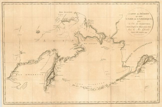
“Carte du Detroit qui Separe l'Asie de l'Amerique, avec la Cote des Tschoutskis, Tracee d'Apres Les Observations faites dans la Mer Glaciale Depuis 1786 Jusqu'en 1794”
Map Maker:
Martin Sauer
This scarce map is focused on the Bering Strait be... (full text available to subscribers)
| Item Detail |
| |
| |
MapMaker: |
Martin Sauer
|
|
| |
| |
Subject: |
North Pacific Ocean |
|
| |
Period/Size: |
1802 / 15.5" x 24.0" (39.4 x 61.0 cm)
|
|
| |
Color: |
Black & White
|
|
| |
Condition: |
(+B) Sharp impression on good paper with a couple tiny pinholes. Issued folding, now flattened - some fold separations reinforced on verso. A faint smudge in lower right and some uneven light toning. (condition help) |
|
| |
Source: |
An Account of a Geographical and Astronomical Expedition. . . |
|
| |
References: |
|
|
| |
|
|
| Sales Information |
| |
| |
Price: |
|
|
| |
| |
Offered by: |
Old World Auctions |
|
| |
Catalog: |
Auction No. 131 - Antique Maps, Charts, Atlases & Globes (682) |
|
| |
Lot/Item #: |
882 |
|
| |
| |
Date: |
02/2010
|
|
| |
| |
|
Antique Maps - Valuation and Pricing, Descriptions, Resources |
|
Home |
Information |
Search |
Register |
Contact Us |
Site Map
Americana Exchange, Inc. © 1999 - 2024 Americana Exchange, Inc.. All rights reserved.
OldMaps.com, the OldMaps.com logo and
AMPR are service marks or registered service marks of Americana Exchange, Inc..
|