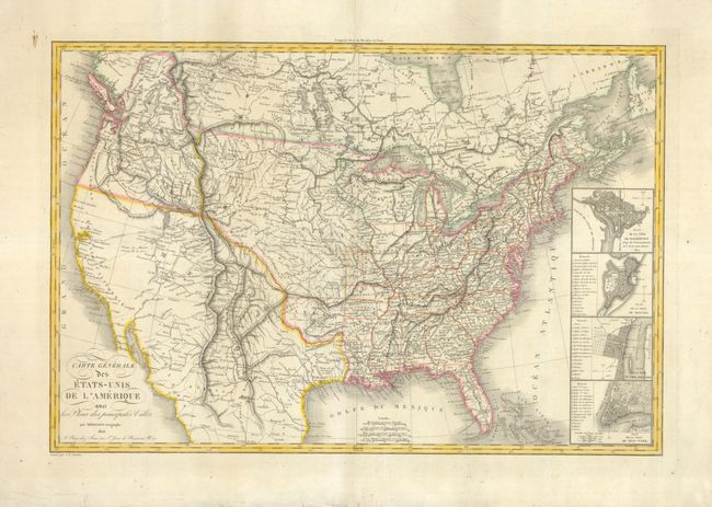
Title:
“Carte General des Etats-Unis de l'Amerique avec les Plans des Principales Villes”
Map Maker:
Eustache Herisson
This great map of the United States extends across... (full text available to subscribers)
| Item Detail |
| |
| |
MapMaker: |
Eustache Herisson
|
|
| |
| |
Subject: |
United States |
|
| |
Period/Size: |
1826 / 19.8" x 29.5" (50.3 x 75.0 cm)
|
|
| |
Color: |
Colored
|
|
| |
Condition: |
(A) The map images is fine with no flaws. On thick paper with huge margins. Some roughness at edges with some tissue applied professionally to verso along edges. (condition help) |
|
| |
Source: |
|
|
| |
References: |
Wheat (TMW) 371. |
|
| |
|
|
| Sales Information |
| |
| |
Price: |
|
|
| |
| |
Offered by: |
Old World Auctions |
|
| |
Catalog: |
Auction No. 131 - Antique Maps, Charts, Atlases & Globes (682) |
|
| |
Lot/Item #: |
171 |
|
| |
| |
Date: |
02/2010
|
|
| |
| |
|
Antique Maps - Valuation and Pricing, Descriptions, Resources |
|
Home |
Information |
Search |
Register |
Contact Us |
Site Map
Americana Exchange, Inc. © 1999 - 2024 Americana Exchange, Inc.. All rights reserved.
OldMaps.com, the OldMaps.com logo and
AMPR are service marks or registered service marks of Americana Exchange, Inc..
|