| Item Detail |
| |
| |
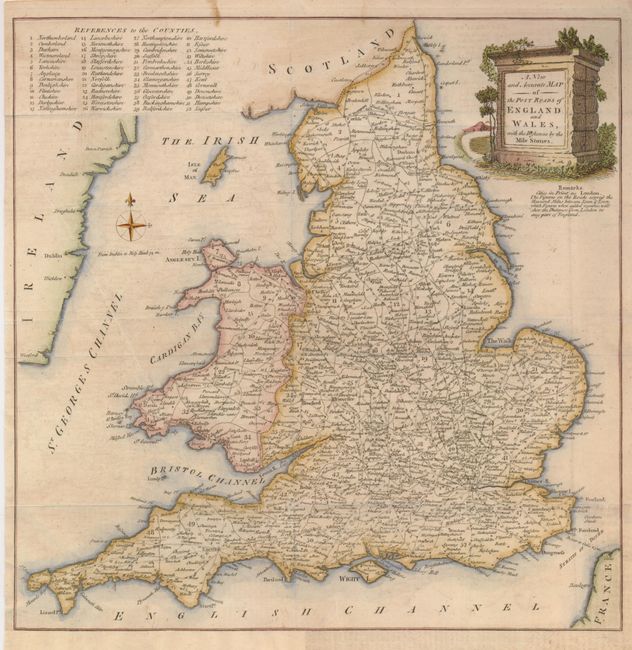
MapMaker: |
Anonymous
|
|
| |
| |
Subject: |
England & Wales |
|
| |
Period/Size: |
1765 / 13.3" x 13.0" (33.8 x 33.1 cm)
|
|
| |
Color: |
Colored
|
|
| |
Condition: |
(+B) Issued folded, now flattened with a couple fold intersections reinforced on verso with light tissue. The binding trim has been replaced with facsimile of the neatline at bottom left. (condition help) |
|
| |
Source: |
Universal Magazine |
|
| |
References: |
Jolly UNIV-121. |
|
| |
|
|
| Sales Information |
| |
| |
Price: |
|
|
| |
| |
Offered by: |
Old World Auctions |
|
| |
Catalog: |
Auction No. 131 - Antique Maps, Charts, Atlases & Globes (682) |
|
| |
Lot/Item #: |
517 |
|
| |
| |
Date: |
02/2010
|
|
| |
| |
|