Title:
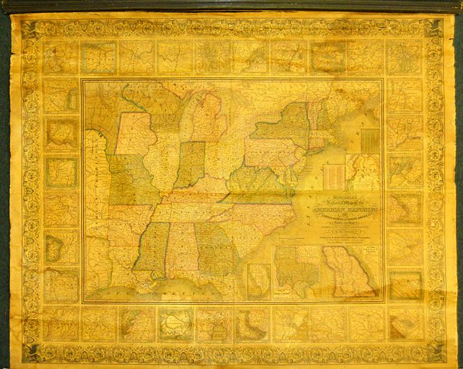
“Mitchell's National Map of the American Republic or United States of North America Together with Maps of the Vicinities of Thirty-Two of the Principal Cities and Towns in the Union”
Map Maker:
Samuel Augustus Mitchell
This is a very nice wall map that was drawn by J.H... (full text available to subscribers)
| Item Detail |
| |
| |
MapMaker: |
Samuel Augustus Mitchell
|
|
| |
| |
Subject: |
Eastern United States |
|
| |
Period/Size: |
1846 / 38.0" x 47.0" (96.6 x 119.4 cm)
|
|
| |
Color: |
Colored
|
|
| |
Condition: |
(+B) The varnish is very nice with just a hint of darkening and just a trace of water staining visible at top and bottom. The map image is very good to fine, but there is a 6" crack in top margin. The upper wooden stick is mostly detached and the lower (condition help) |
|
| |
Source: |
|
|
| |
References: |
|
|
| |
|
|
| Sales Information |
| |
| |
Price: |
|
|
| |
| |
Offered by: |
Old World Auctions |
|
| |
Catalog: |
Auction No. 131 - Antique Maps, Charts, Atlases & Globes (682) |
|
| |
Lot/Item #: |
199 |
|
| |
| |
Date: |
02/2010
|
|
| |
| |
|
Antique Maps - Valuation and Pricing, Descriptions, Resources |
|
Home |
Information |
Search |
Register |
Contact Us |
Site Map
Americana Exchange, Inc. © 1999 - 2024 Americana Exchange, Inc.. All rights reserved.
OldMaps.com, the OldMaps.com logo and
AMPR are service marks or registered service marks of Americana Exchange, Inc..
|