Title:
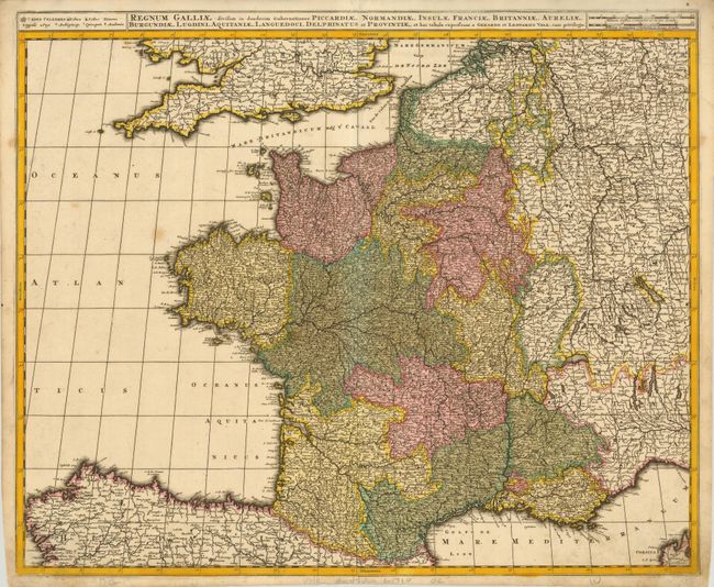
“Regnum Galliae: divisum in duodecim Gubernationes Piccardiae, Normandiae, Insulae Franciae, Britanniae, Aureliae, Burgundiae, Lugdini, Aquitaniae, Languedoci, Delphinatus et Provintiae …”
Map Maker:
Valk [Family]
This map of France is densely engraved with place ... (full text available to subscribers)
| Item Detail |
| |
| |
MapMaker: |
Valk [Family]
|
|
| |
| |
Subject: |
France |
|
| |
Period/Size: |
1700 / 19.3" x 23.5" (49.1 x 59.7 cm)
|
|
| |
Color: |
Colored
|
|
| |
Condition: |
(+B) Dark impression with original color. There is some minor toning and a few spots of foxing. (condition help) |
|
| |
Source: |
|
|
| |
References: |
|
|
| |
|
|
| Sales Information |
| |
| |
Price: |
|
|
| |
| |
Offered by: |
Old World Auctions |
|
| |
Catalog: |
Auction No. 131 - Antique Maps, Charts, Atlases & Globes (682) |
|
| |
Lot/Item #: |
584 |
|
| |
| |
Date: |
02/2010
|
|
| |
| |
|
Antique Maps - Valuation and Pricing, Descriptions, Resources |
|
Home |
Information |
Search |
Register |
Contact Us |
Site Map
Americana Exchange, Inc. © 1999 - 2024 Americana Exchange, Inc.. All rights reserved.
OldMaps.com, the OldMaps.com logo and
AMPR are service marks or registered service marks of Americana Exchange, Inc..
|