| Item Detail |
| |
| |
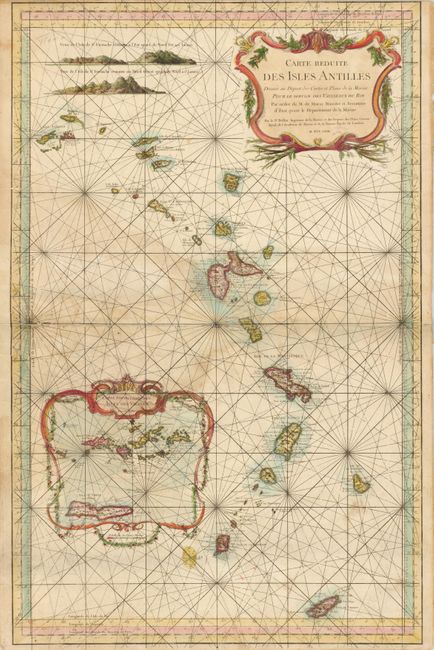
MapMaker: |
Jacques Nicolas Bellin
|
|
| |
| |
Subject: |
Lesser Antilles |
|
| |
Period/Size: |
1758 / 34.6" x 22.3" (87.9 x 56.7 cm)
|
|
| |
Color: |
Colored
|
|
| |
Condition: |
(+C) There a light damp stain entering the map at center left and several old paper repairs in this area. There is a 2" tear into the left side above this area. The top margin is closely trimmed, apparently as issued. (condition help) |
|
| |
Source: |
|
|
| |
References: |
|
|
| |
|
|
| Sales Information |
| |
| |
Price: |
|
|
| |
| |
Offered by: |
Old World Auctions |
|
| |
Catalog: |
Auction No. 131 - Antique Maps, Charts, Atlases & Globes (682) |
|
| |
Lot/Item #: |
439 |
|
| |
| |
Date: |
02/2010
|
|
| |
| |
|