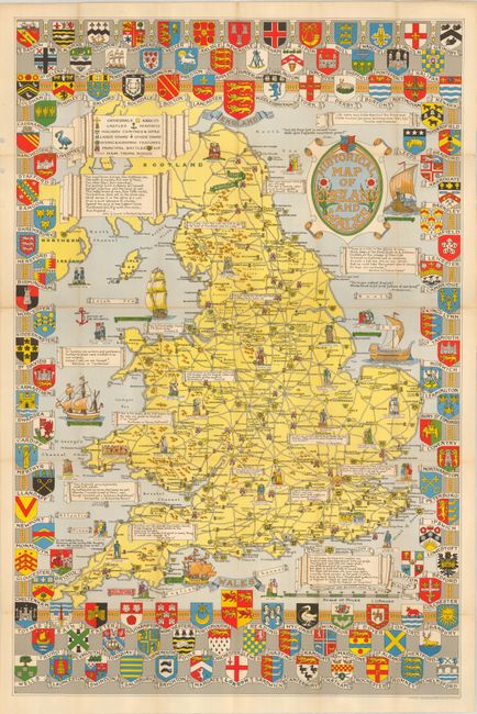
Title:
“Historical Map of England and Wales”
Map Maker:
John Bartholomew, Sr.
This great tourist pocket map is drawn in the whim... (full text available to subscribers)
| Item Detail |
| |
| |
MapMaker: |
John Bartholomew, Sr.
|
|
| |
| |
Subject: |
England & Wales |
|
| |
Period/Size: |
1950 / 24.8" x 37.5" (63.0 x 95.3 cm)
|
|
| |
Color: |
Colored
|
|
| |
Condition: |
(A) Very nice and near fine example. Front cover has a hole punch at lower right. Rear cover with some light abrasion at center. There is a short fold separation in the top blank margin. (condition help) |
|
| |
Source: |
|
|
| |
References: |
|
|
| |
|
|
| Sales Information |
| |
| |
Price: |
|
|
| |
| |
Offered by: |
Old World Auctions |
|
| |
Catalog: |
Auction No. 131 - Antique Maps, Charts, Atlases & Globes (682) |
|
| |
Lot/Item #: |
518 |
|
| |
| |
Date: |
02/2010
|
|
| |
| |
|
Antique Maps - Valuation and Pricing, Descriptions, Resources |
|
Home |
Information |
Search |
Register |
Contact Us |
Site Map
Americana Exchange, Inc. © 1999 - 2024 Americana Exchange, Inc.. All rights reserved.
OldMaps.com, the OldMaps.com logo and
AMPR are service marks or registered service marks of Americana Exchange, Inc..
|