| Item Detail |
| |
| |
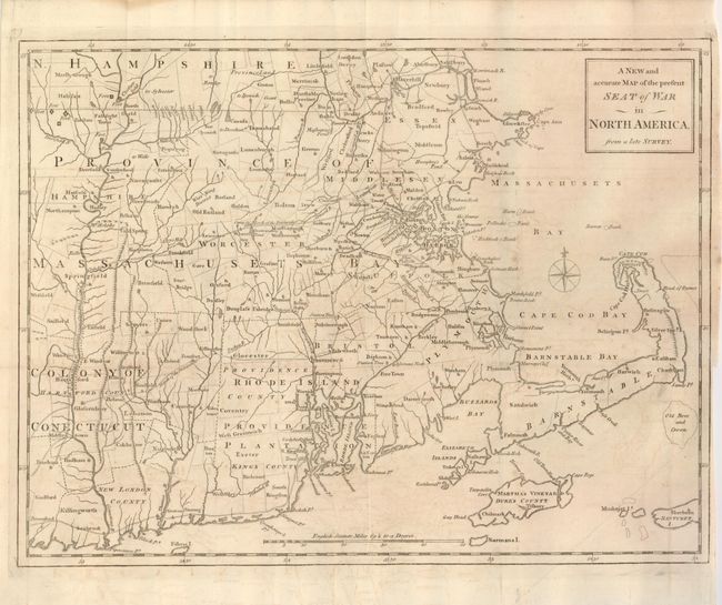
MapMaker: |
Anonymous
|
|
| |
| |
Subject: |
Colonial New England |
|
| |
Period/Size: |
1775 / 11.3" x 15.0" (28.7 x 38.1 cm)
|
|
| |
Color: |
Black & White
|
|
| |
Condition: |
(+B) Issued folded, now flattened, with expert, and now invisible, repair of a 4" binding tear at right. The binding side margin is narrow, varying between 1/16" and 1/4". There is a bit of faint offsetting within the map. (condition help) |
|
| |
Source: |
Universal Magazine |
|
| |
References: |
Jolly UNIV-173; McCorkle #775.11; Sellers & Van Ee #814; Phillips (M) p. 585. |
|
| |
|
|
| Sales Information |
| |
| |
Price: |
|
|
| |
| |
Offered by: |
Old World Auctions |
|
| |
Catalog: |
Auction No. 131 - Antique Maps, Charts, Atlases & Globes (682) |
|
| |
Lot/Item #: |
205 |
|
| |
| |
Date: |
02/2010
|
|
| |
| |
|