Title:
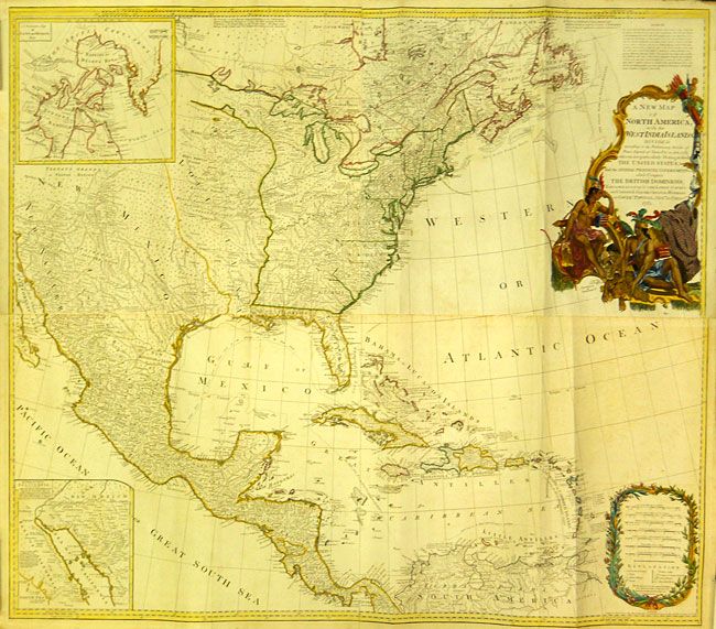
“A New Map of North America, with the West India Islands, Divided According to the Preliminary Articles of Peace Signed at Versailles 20 Jan. 1783, wherein are Particularly Distinguished the United States and the Several Provinces, Governments …”
Map Maker:
Robert Sayer
This large, influential map had a long and varied ... (full text available to subscribers)
| Item Detail |
| |
| |
MapMaker: |
Robert Sayer
|
|
| |
| |
Subject: |
North America |
|
| |
Period/Size: |
1786 / 40.0" x 46.0" (101.6 x 116.9 cm)
|
|
| |
Color: |
Colored
|
|
| |
Condition: |
(+B) There is a bit of minor toning and faint offsetting - generally much better condition than is usual for this map due to its size. (condition help) |
|
| |
Source: |
|
|
| |
References: |
Stevens & Tree #49-j. |
|
| |
|
|
| Sales Information |
| |
| |
Price: |
|
|
| |
| |
Offered by: |
Old World Auctions |
|
| |
Catalog: |
Auction No. 131 - Antique Maps, Charts, Atlases & Globes (682) |
|
| |
Lot/Item #: |
120 |
|
| |
| |
Date: |
02/2010
|
|
| |
| |
|
Antique Maps - Valuation and Pricing, Descriptions, Resources |
|
Home |
Information |
Search |
Register |
Contact Us |
Site Map
Americana Exchange, Inc. © 1999 - 2024 Americana Exchange, Inc.. All rights reserved.
OldMaps.com, the OldMaps.com logo and
AMPR are service marks or registered service marks of Americana Exchange, Inc..
|