Title:
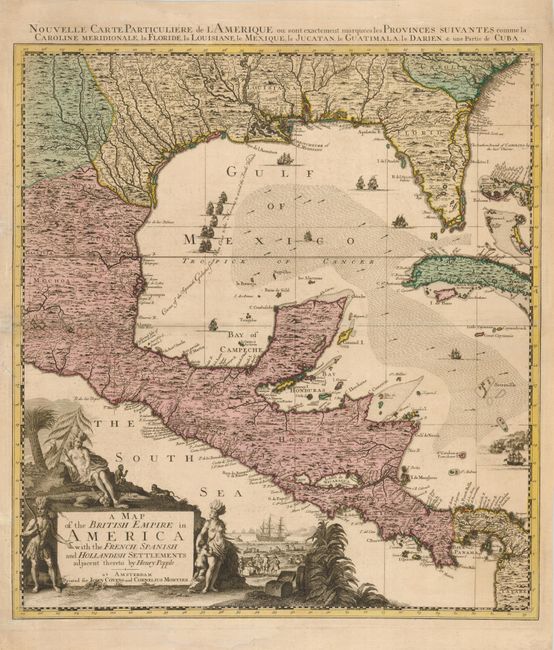
“A Map of the British Empire in America with the French, Spanish and Hollandish Settlements adjacent thereto by Henry Popple”
Map Maker:
Popple/Covens & Mortier
This striking map, which stands completely on its ... (full text available to subscribers)
| Item Detail |
| |
| |
MapMaker: |
Popple/Covens & Mortier
|
|
| |
| |
Subject: |
Gulf of Mexico |
|
| |
Period/Size: |
1740 / 23.0" x 20.6" (58.5 x 52.4 cm)
|
|
| |
Color: |
Colored
|
|
| |
Condition: |
(+B) Sharp impression and fine original color. There is old paper reinforcement in the left margin and a small repair on the centerfold, also at left. (condition help) |
|
| |
Source: |
|
|
| |
References: |
cf Cumming (SE) #231; McCorkle #741.2. |
|
| |
|
|
| Sales Information |
| |
| |
Price: |
|
|
| |
| |
Offered by: |
Old World Auctions |
|
| |
Catalog: |
Auction No. 131 - Antique Maps, Charts, Atlases & Globes (682) |
|
| |
Lot/Item #: |
411 |
|
| |
| |
Date: |
02/2010
|
|
| |
| |
|
Antique Maps - Valuation and Pricing, Descriptions, Resources |
|
Home |
Information |
Search |
Register |
Contact Us |
Site Map
Americana Exchange, Inc. © 1999 - 2024 Americana Exchange, Inc.. All rights reserved.
OldMaps.com, the OldMaps.com logo and
AMPR are service marks or registered service marks of Americana Exchange, Inc..
|