Rister or Sign In to see pricing information


Title:

Map of the States of Indiana and Ohio, with Part of Michigan Territory

Map Maker:

John Hinton

Map of the States of Indiana and Ohio, with Part of Michigan Territory

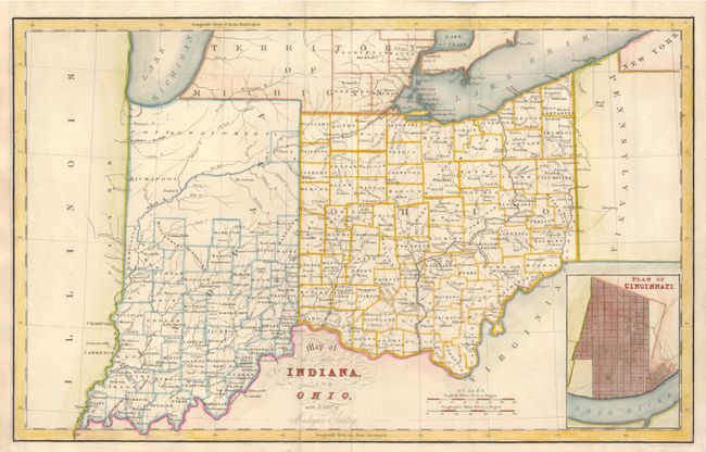
This attractive early 19th century map shows with ... (full text available to subscribers)
Item Detail
 
  MapMaker:  

John Hinton


  Subject:  Midwestern United States  
  Period/Size:  1831 / 9.7" x 15.5"  (24.7 x 39.4 cm)  
  Color:  Colored  
  Condition:  (+B) Issued folded, now flattened with the binding side (at left) margin replaced to better accommodate framing. (condition help)  
  Source:  History of the United States  
  References:   
 
 
Sales Information
 
  Price: 

Please register your email to view records, or sign in with email address to see records


  Offered by:  Old World Auctions  
  Catalog:  Auction No. 131 - Antique Maps, Charts, Atlases & Globes (682)  
  Lot/Item #:  245  
 
  Date:  02/2010  


Antique Maps - Valuation and Pricing, Descriptions, Resources


Home | Information | Search | Register | Contact Us | Site Map

Americana Exchange, Inc. © 1999 - 2024 Americana Exchange, Inc.. All rights reserved. OldMaps.com, the OldMaps.com logo and
AMPR are service marks or registered service marks of Americana Exchange, Inc..